$ 0.00
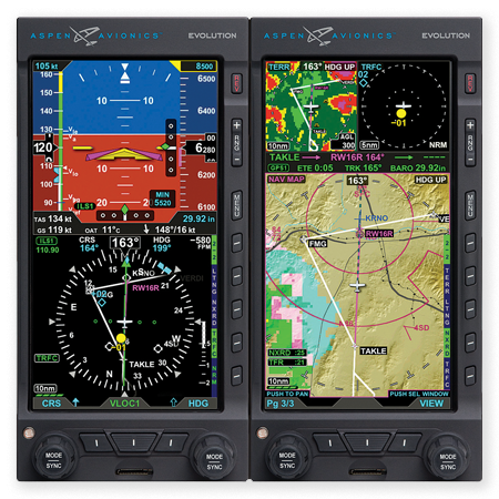
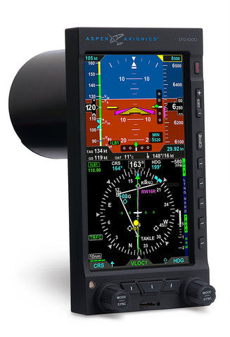
Airspeed and altitude tapes
Altitude alerter (and separate approach minimums alerting)
Full electronic HSI with dual bearing pointers
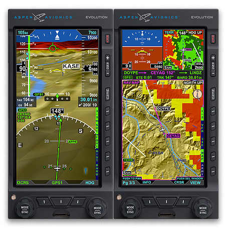
Base map with flight plan legs and waypoints, curved flight paths(1), and nearby navaids
Integrates with most GA autopilot and flight director systems
ARC and 360º views with dual GPS and dual VHF nav support
Built-in GPS Steering(1)
Display of real-time winds aloft, OAT, TAS, and ground speed(1)
Integral Air Data Computer and Attitude Heading Reference System (ADAHRS)
Built-in backup battery and emergency GPS(6)
Optional Evolution Synthetic Vision(4)
Optional Evolution Hazard Awareness (EHA) upgrade provides traffic and weather displays(2, 3)
High resolution aviation-style moving maps with hazard awareness overlays
Customizable screen layouts
Geo-referenced charts and airport diagrams
Secondary HSI
Evolution Hazard Awareness (EHA)
Built-in Terrain Awareness system
Traffic(2)
WX500 Stormscope® compatibility
XM WX® Satellite Weather, with all XM WX aviation weather products(3)
Brilliant, direct sunlight-readable, 6-inch 760x400 TFT active matrix LCD display (140 pixels/inch)
$ 0.00
Features include:Solid-state Attitude and Heading Reference System (AHRS)Backup battery and emergency GPS with 30 minutes...
$ 0.00
Dual Independent LCD DisplaysRedundant Solid-State Attitude Heading Reference Systems with Independent Gyro, Accelerometer and Magnetic...